Focus on the BIG picture.
Tuesday, Jan 27, 2026
Outside the box.


Unusual Atmospheric Collision Made Washington’s Sunday Winter Storm Exceptional
Rare mix of heavy sleet, heavy snow and intense Arctic cold produced an unusually disruptive storm in the nation’s capital
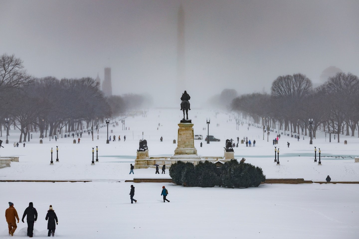
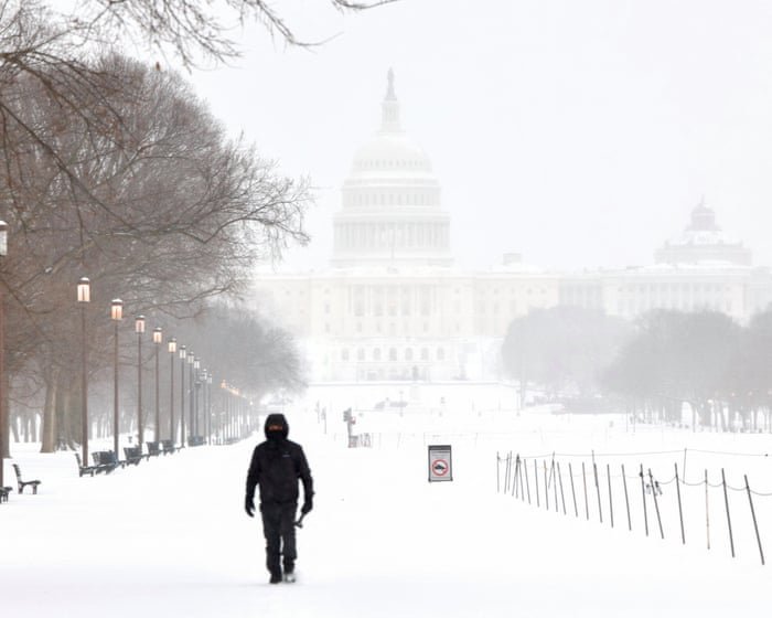
The Washington, D.C., area experienced an exceptional winter storm on Sunday that was driven not merely by the volume of precipitation but by the unprecedented combination of heavy sleet and snow falling amid deep Arctic cold.
Meteorologists describe the event as extraordinary because of how rarely sleet accumulates in such significant amounts in the region, particularly at temperatures predominantly in the teens, creating dense, icy conditions that differ markedly from a typical snowstorm.
This mixture resulted in a frozen layer up to 6 to 9 inches deep — with the water content equivalent to about two inches of rain — making cleanup and travel far more difficult than usual.
A defining feature of the storm was the unusual quantity of sleet, which fell in amounts up to 2 to 4 inches atop 4 to 7 inches of snow, a combination unmatched in recent decades.
While sleet normally remains at low levels during winter systems, this storm’s intense Arctic air mass — often referred to as the “Siberian Express” — collided with a moisture-rich subtropical jet stream known as the “Pineapple Express,” creating an environment conducive to heavy sleet and snow.
Such a rare juxtaposition of air masses over the Mid-Atlantic meant that forecasters and residents alike faced a complex and evolving weather picture.
The storm’s impacts were amplified by sustained frigid temperatures; with highs barely above the teens and forecasts calling for single-digit lows in the days that followed, the frozen precipitation is expected to persist, prolonging disruptions to travel, commuting and snow removal efforts.
D.C. recorded 6.9 inches of frozen precipitation — the third-highest total since the notable 2016 “Snowzilla.” Across the broader storm system that affected much of the United States, winter weather warnings were issued from western Texas to New England, highlighting the widespread and severe nature of the event.
Forecasting the storm proved challenging due to the shifting balance between snow, sleet and freezing rain as the system moved through the region.
Weather models grappled with narrow temperature margins that determined precipitation type, leading to varied predictions up until the storm’s arrival.
Ultimately, sleet dominated in the immediate D.C. area, sparing major power outages but creating a treacherous, ice-bound surface.
Analysts note that the unusual sleet accumulation and persistent cold set this storm apart from typical East Coast winter events, placing it alongside other significant regional weather phenomena in recent years.