Focus on the BIG picture.
Sunday, Dec 14, 2025
Outside the box.
Washington State Briefly Sees a Break in Torrential Rain as Arctic Cold Grips Midwest and East Coast
Rain eases temporarily in flood-stricken Pacific Northwest even as much of the U.S. braces for bone-chilling temperatures and snow
Washington state is experiencing a short respite from days of torrential rain and flooding as the most intense atmospheric river shifts northward, offering communities a brief window of drier conditions after widespread inundation and emergency declarations.
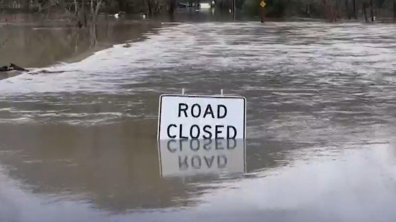
The Pacific Northwest has been battered by sustained heavy rainfall that led to record river levels, extensive evacuations and infrastructure damage across western Washington, prompting authorities to warn that rivers will remain swollen even as precipitation eases temporarily.
Record flooding from this system, fuelled by a prolonged plume of tropical moisture, has caused multiple rivers to crest at dangerous levels and left large areas vulnerable to mudslides and levee stresses.
Forecasters say the break from rain comes as the heaviest bands of precipitation begin moving toward British Columbia and away from much of Washington, though additional atmospheric river events are forecast to arrive later in the week and continue to pose a flood risk.
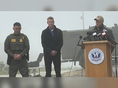
Local officials have emphasised that while rain may diminish for a period, the threat to life and property persists due to saturated ground and high water levels that have not yet fully receded.
Residents in affected counties have been urged to remain vigilant and prepared for renewed rainfall and potential flash flooding as conditions evolve.
Meanwhile, much of the central and eastern United States is bracing for a markedly different weather pattern, with an influx of Arctic air driving temperatures into single digits and below, particularly across the Midwest and the Mid-Atlantic.
Wind chills in these regions are expected to plunge well below freezing, prompting advisories for vulnerable populations to take precautions against hypothermia and frostbite.
Snow and freezing conditions are forecast in parts of the northern Plains and Upper Midwest, compounding travel challenges and heightening the impact of the cold snap.
The contrast in weather reflects a broad dipole pattern across the nation, with the Pacific Northwest’s flood-producing storm system temporarily abating even as frigid air drives a significant cold outbreak from Canada into the heart of the continent.
Meteorologists warn that while Washington’s rain may ease, the risk of additional atmospheric river activity and the ongoing flooding scenario mean that the respite may be brief, and communities remain on alert for further weather developments that could exacerbate both hydrological and winter hazards.
The Pacific Northwest has been battered by sustained heavy rainfall that led to record river levels, extensive evacuations and infrastructure damage across western Washington, prompting authorities to warn that rivers will remain swollen even as precipitation eases temporarily.
Record flooding from this system, fuelled by a prolonged plume of tropical moisture, has caused multiple rivers to crest at dangerous levels and left large areas vulnerable to mudslides and levee stresses.
Forecasters say the break from rain comes as the heaviest bands of precipitation begin moving toward British Columbia and away from much of Washington, though additional atmospheric river events are forecast to arrive later in the week and continue to pose a flood risk.
Local officials have emphasised that while rain may diminish for a period, the threat to life and property persists due to saturated ground and high water levels that have not yet fully receded.
Residents in affected counties have been urged to remain vigilant and prepared for renewed rainfall and potential flash flooding as conditions evolve.
Meanwhile, much of the central and eastern United States is bracing for a markedly different weather pattern, with an influx of Arctic air driving temperatures into single digits and below, particularly across the Midwest and the Mid-Atlantic.
Wind chills in these regions are expected to plunge well below freezing, prompting advisories for vulnerable populations to take precautions against hypothermia and frostbite.
Snow and freezing conditions are forecast in parts of the northern Plains and Upper Midwest, compounding travel challenges and heightening the impact of the cold snap.
The contrast in weather reflects a broad dipole pattern across the nation, with the Pacific Northwest’s flood-producing storm system temporarily abating even as frigid air drives a significant cold outbreak from Canada into the heart of the continent.
Meteorologists warn that while Washington’s rain may ease, the risk of additional atmospheric river activity and the ongoing flooding scenario mean that the respite may be brief, and communities remain on alert for further weather developments that could exacerbate both hydrological and winter hazards.